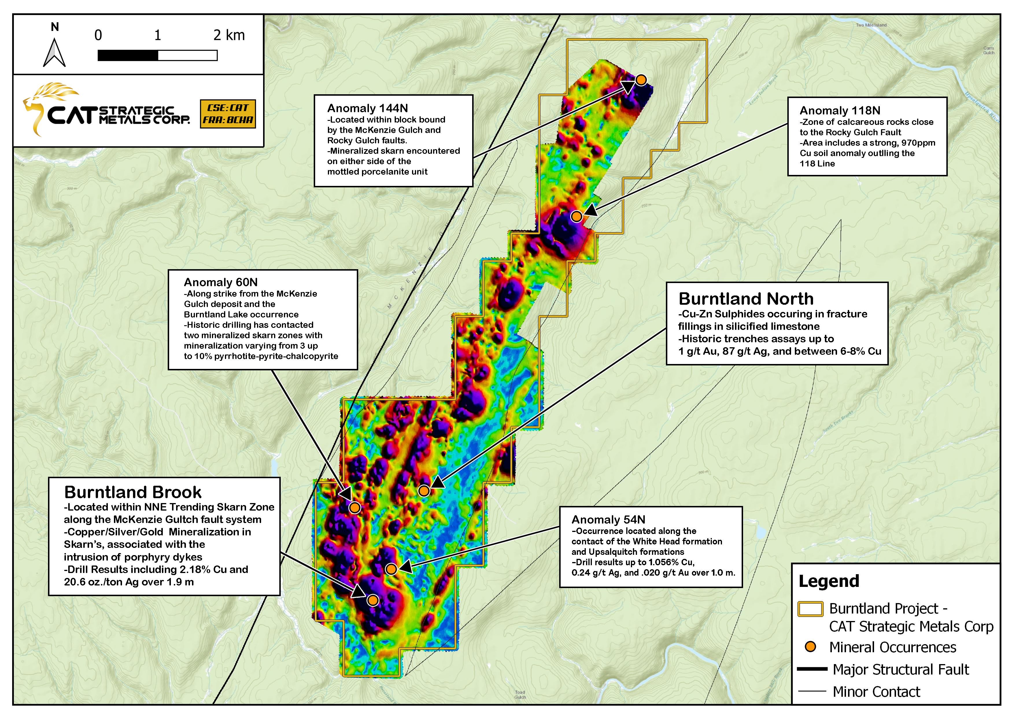
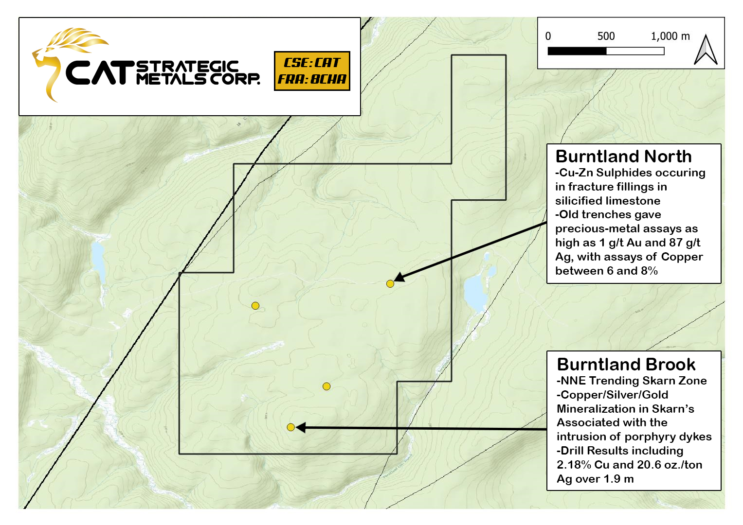
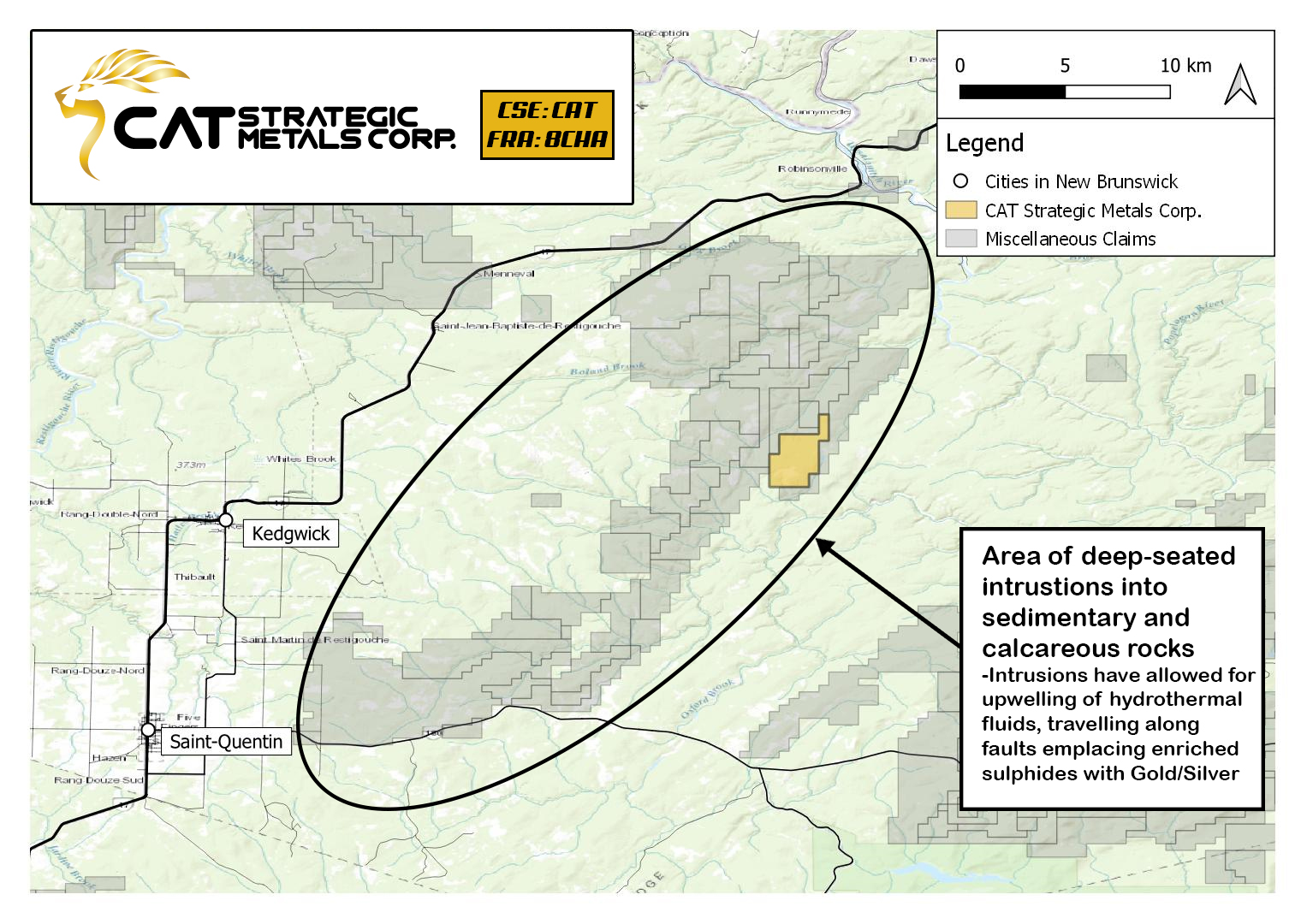
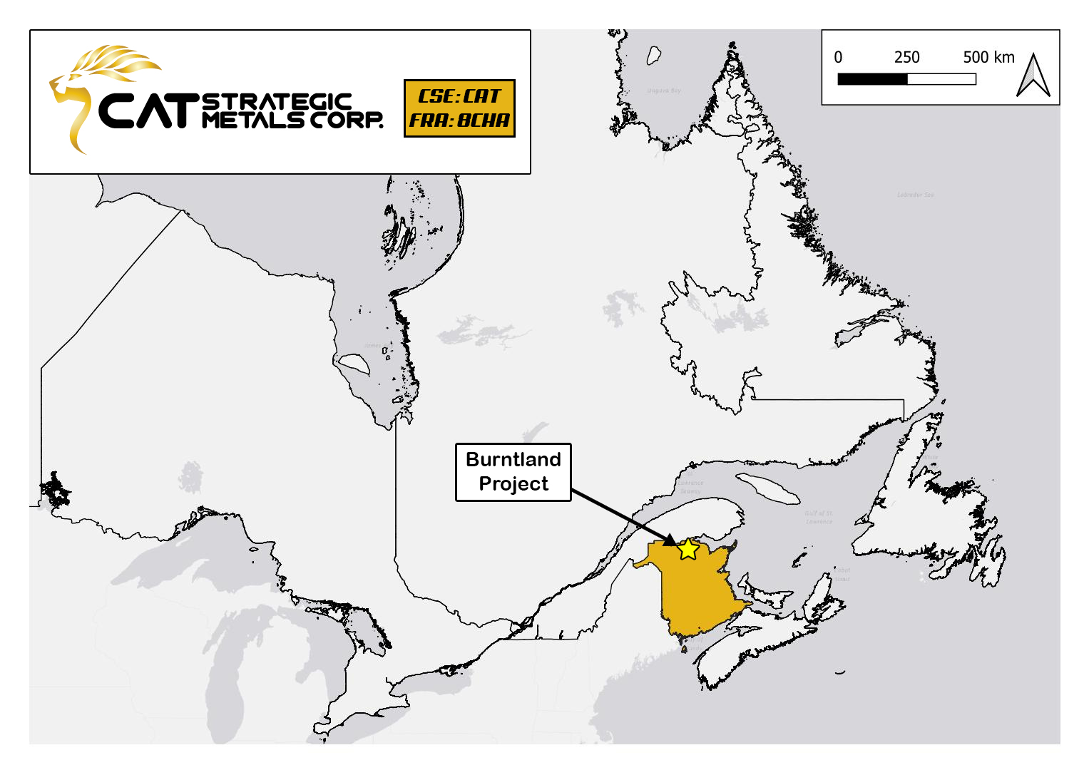
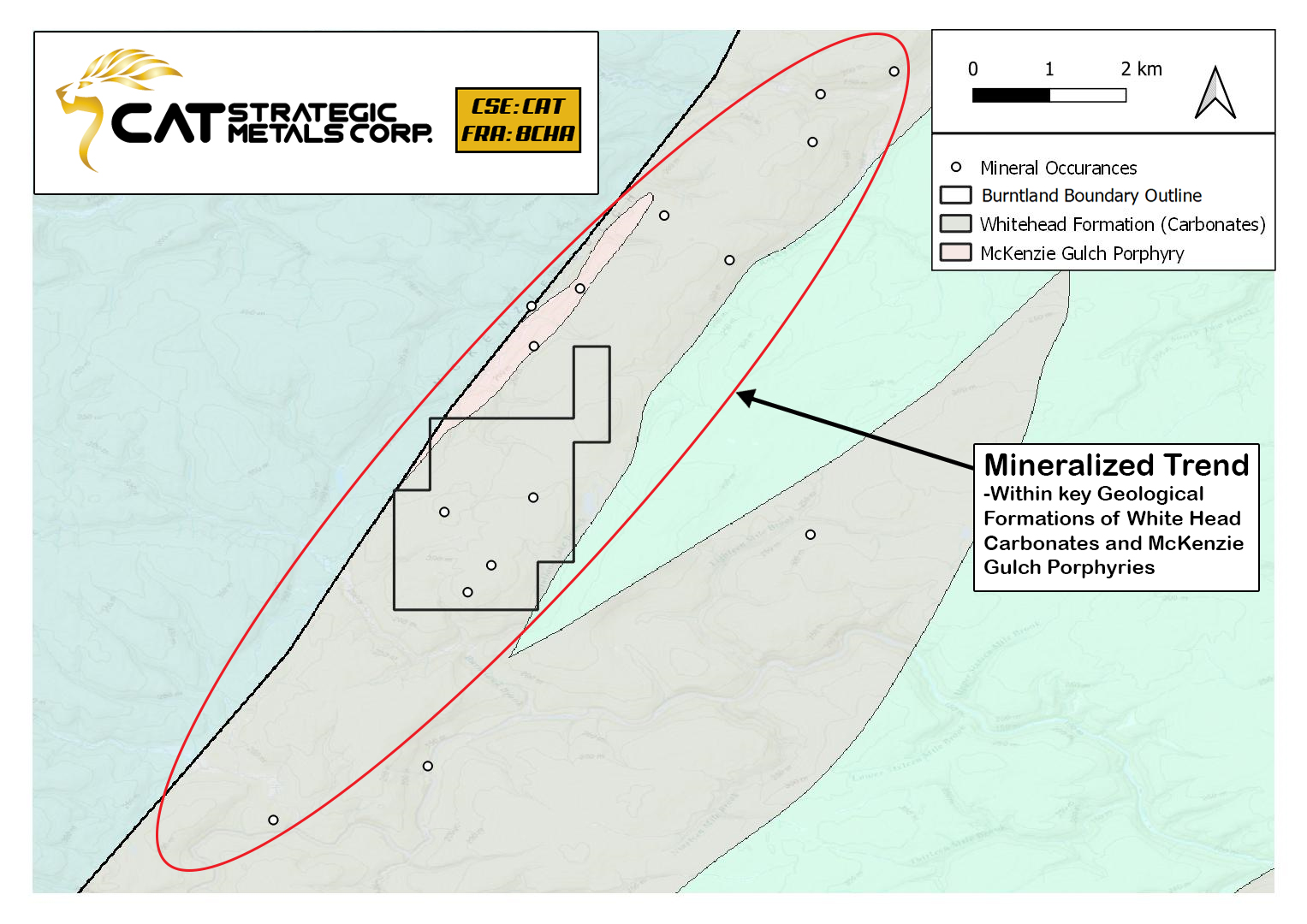
McKenzie Gulch Trend – Burntland Project
Located in NW New Brunswick, Canada, approximately 200 kilometres north-west of Fredericton.
Skarn mineralized zone within the Whitehead suite (Matapedia Group).
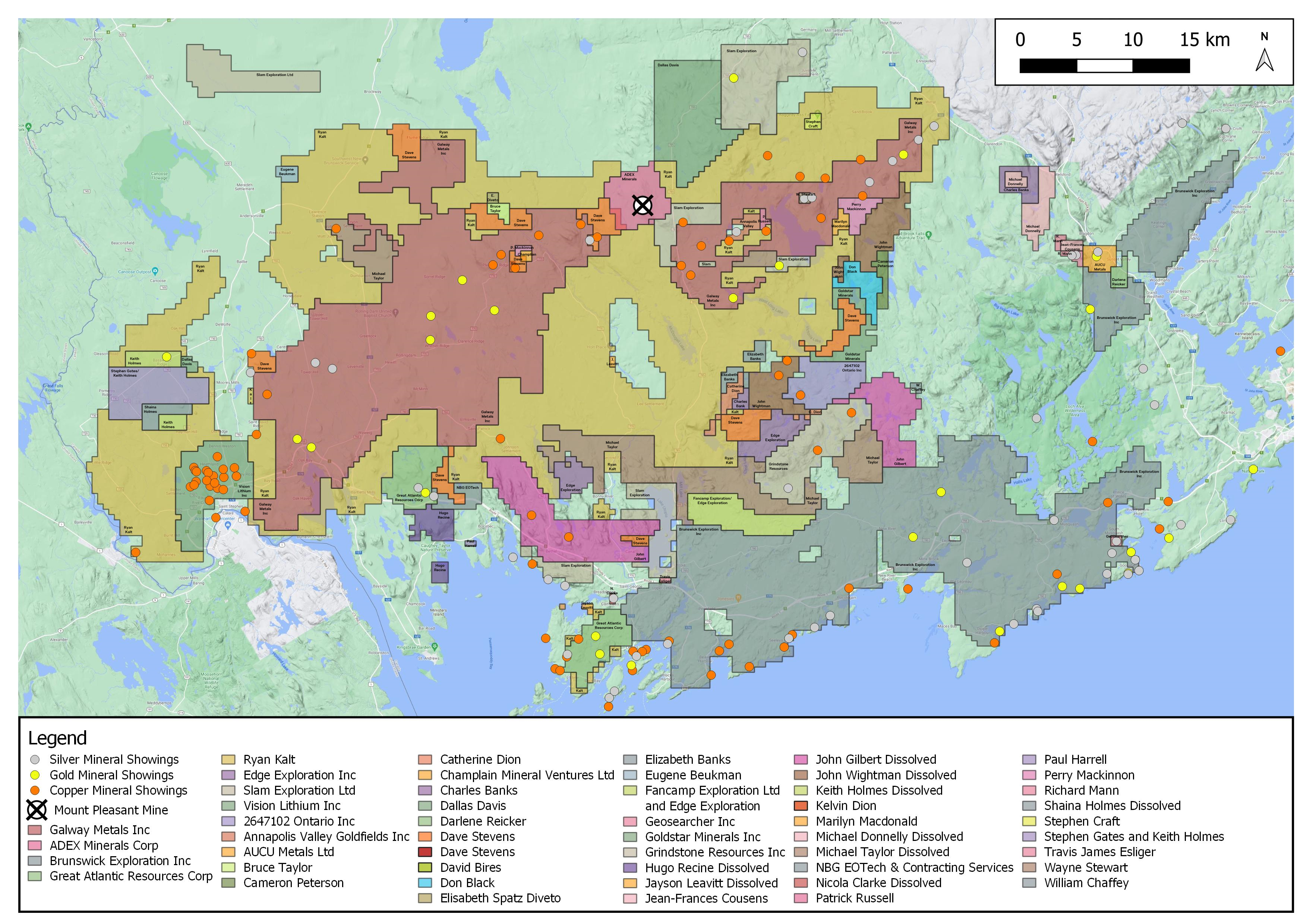
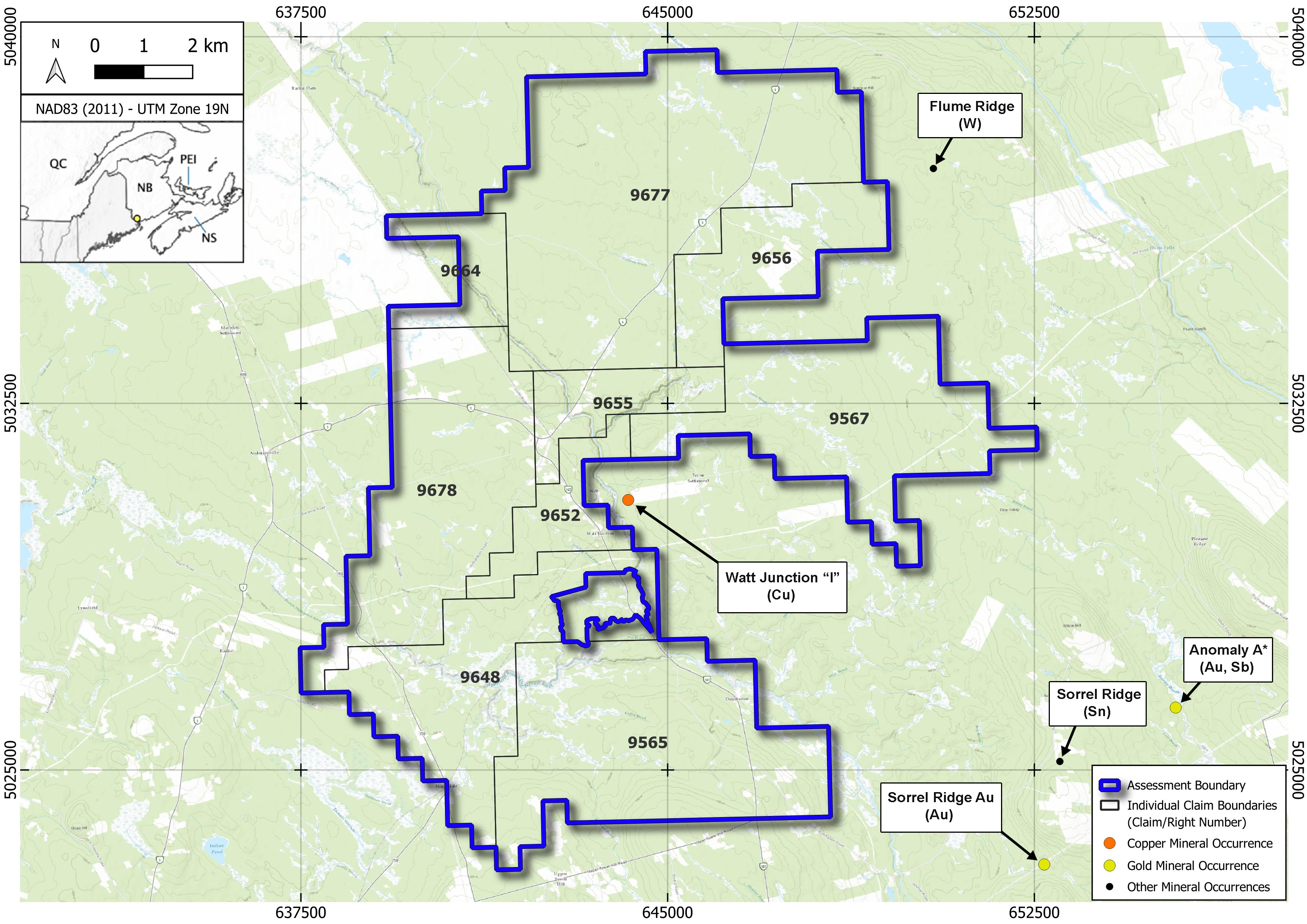
Clarence Stream District – Major Projects
Located in SW New Brunswick, Canada, approximately 70 kilometres south-west of Fredericton.
Displaying major companies within the Clarence Stream District (as of July 2021).
This zone accounts for a portion of the Appalachian Gold Trend closely related to deep-seated orogenic faults.
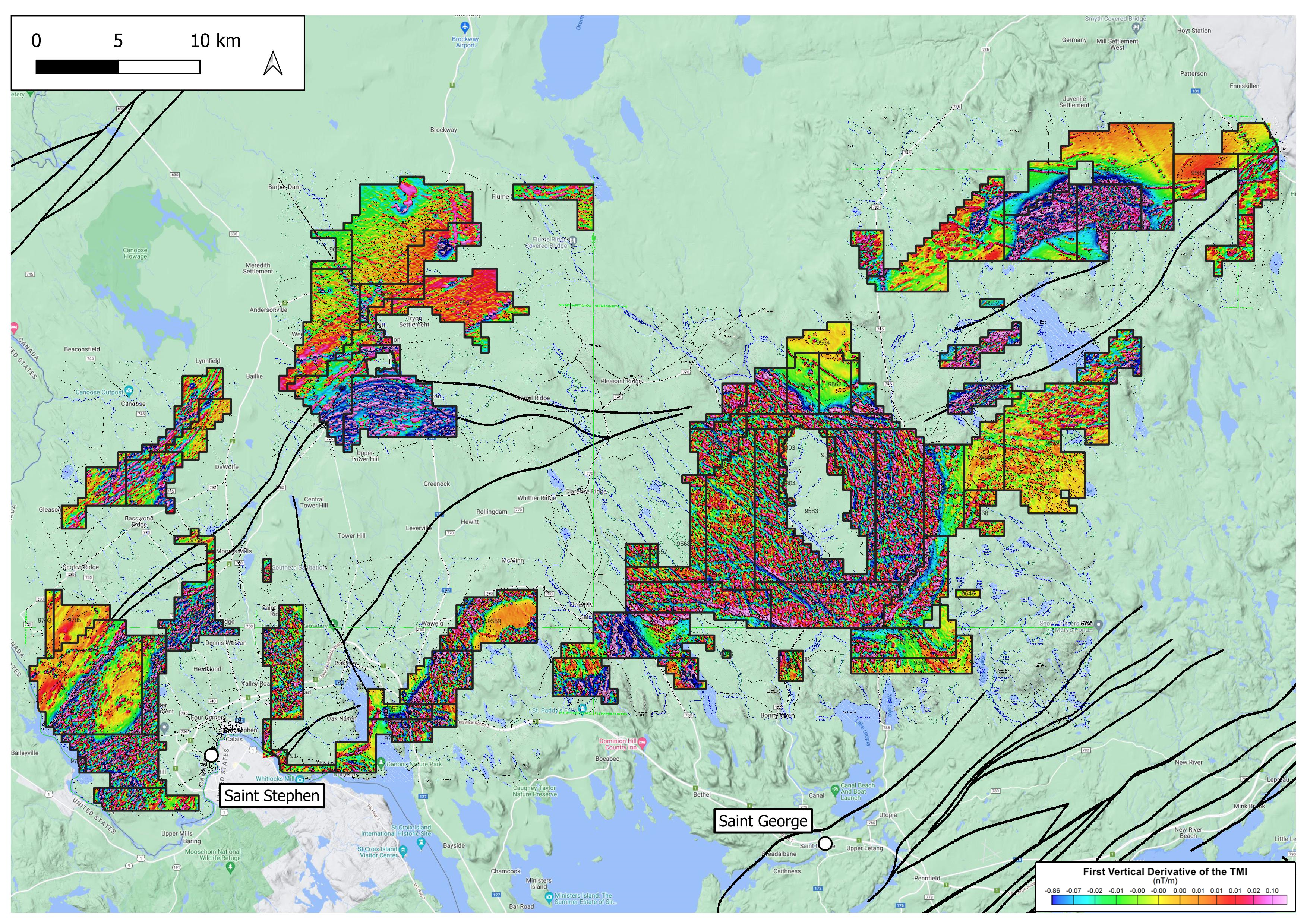
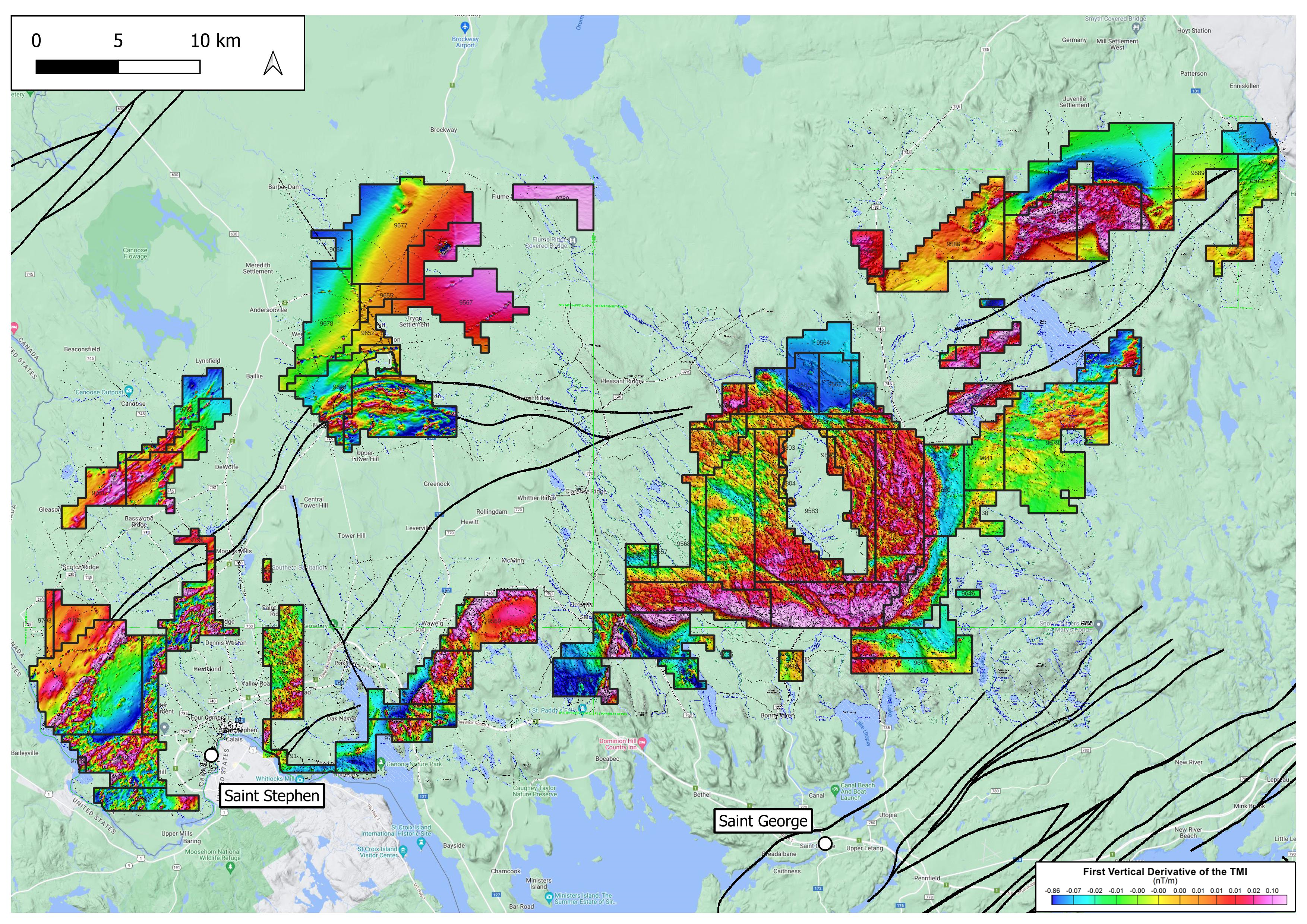
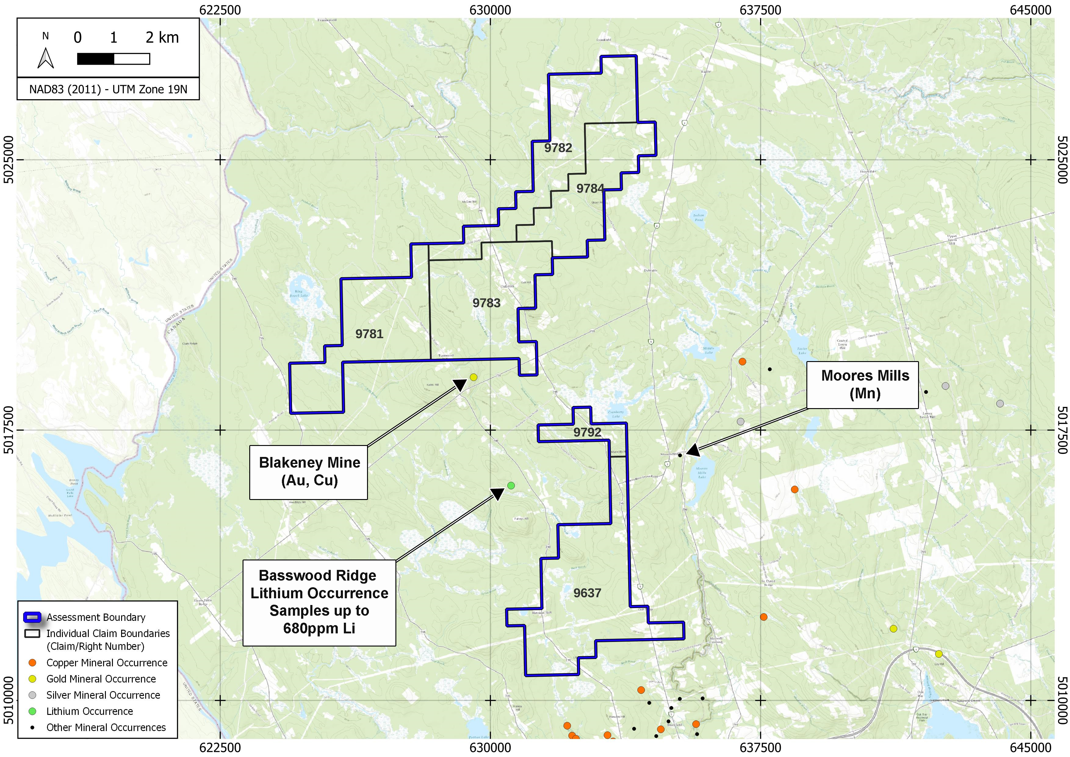
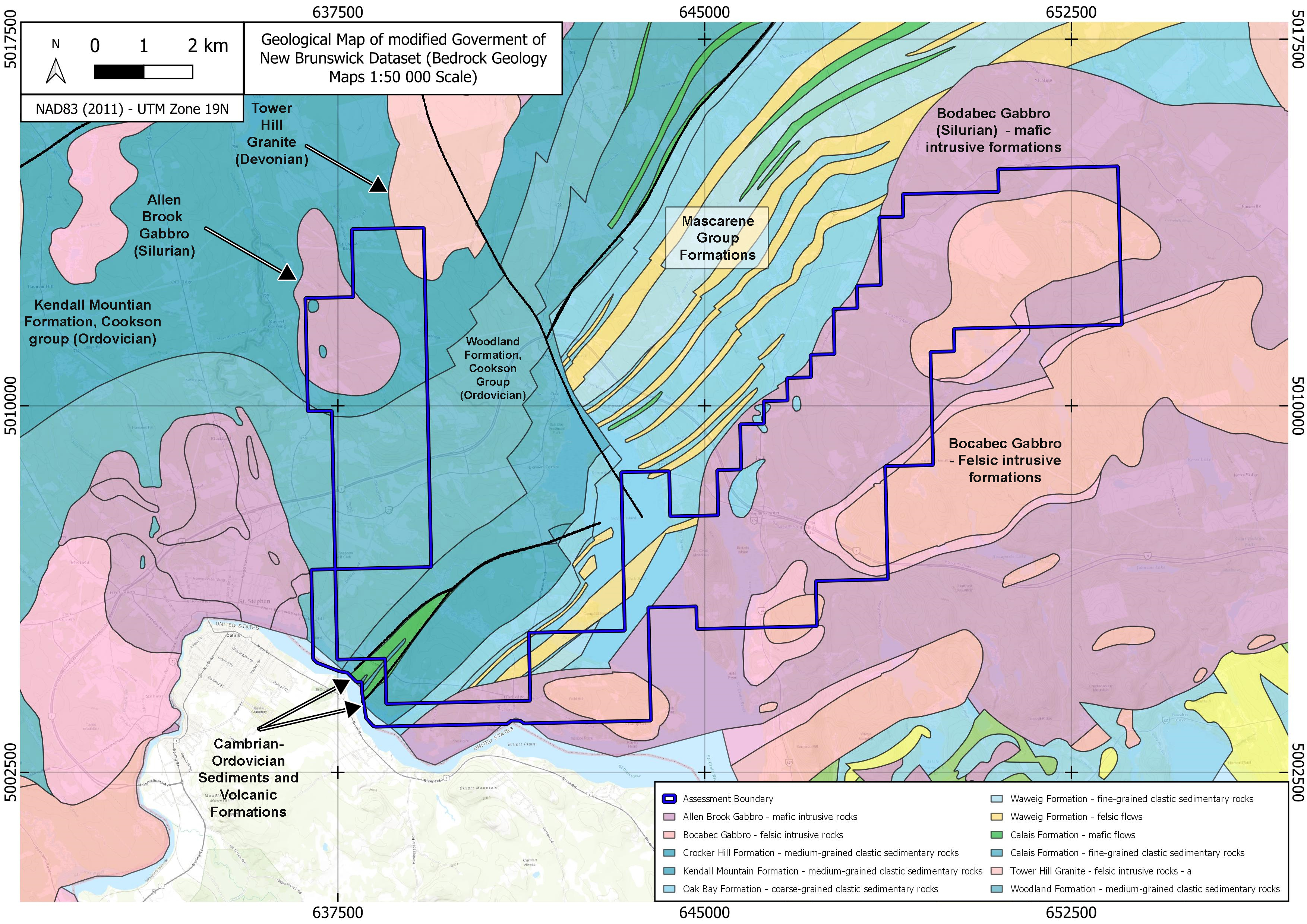
South New Brunswick – Clarence Stream Projects
Located North of Saint John, New Brunswick, Canada. Approximately 75 kilometres south of Fredericton.
Area known to host fault controlled, intrusion related Gold mineralization.
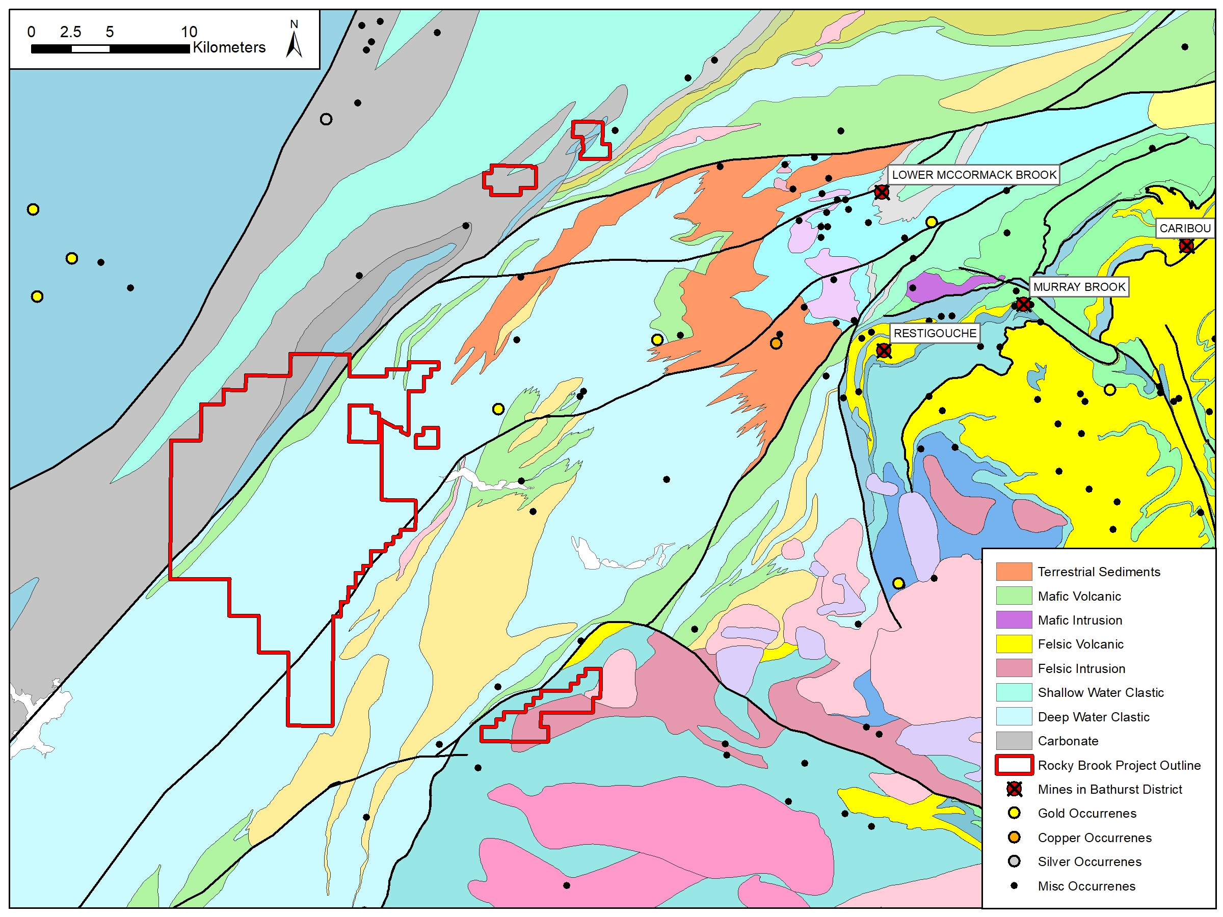
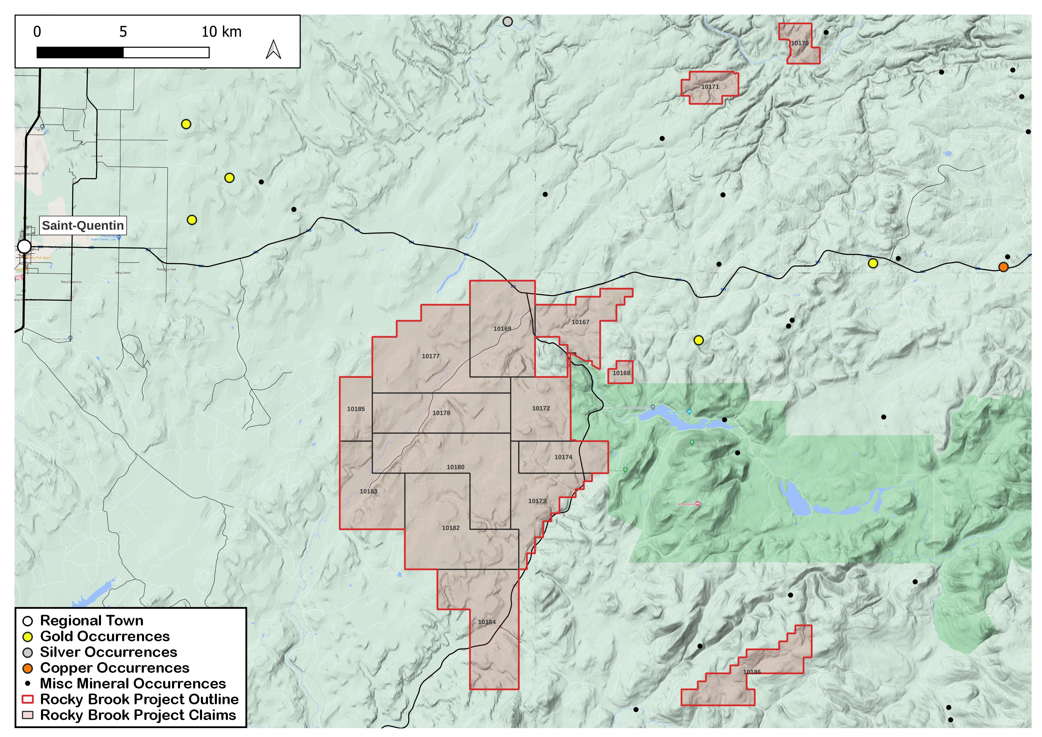
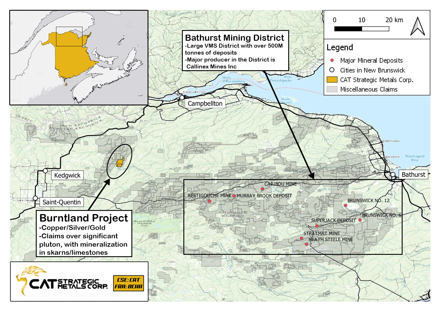
Northern New Brunswick – Rocky Brook Project
Located in Northern New Brunswick, Canada, approximately 75 kilometres North-East of Grand Falls.
Adjacent to Mount Carleton, West of the Bathurst Mining District.