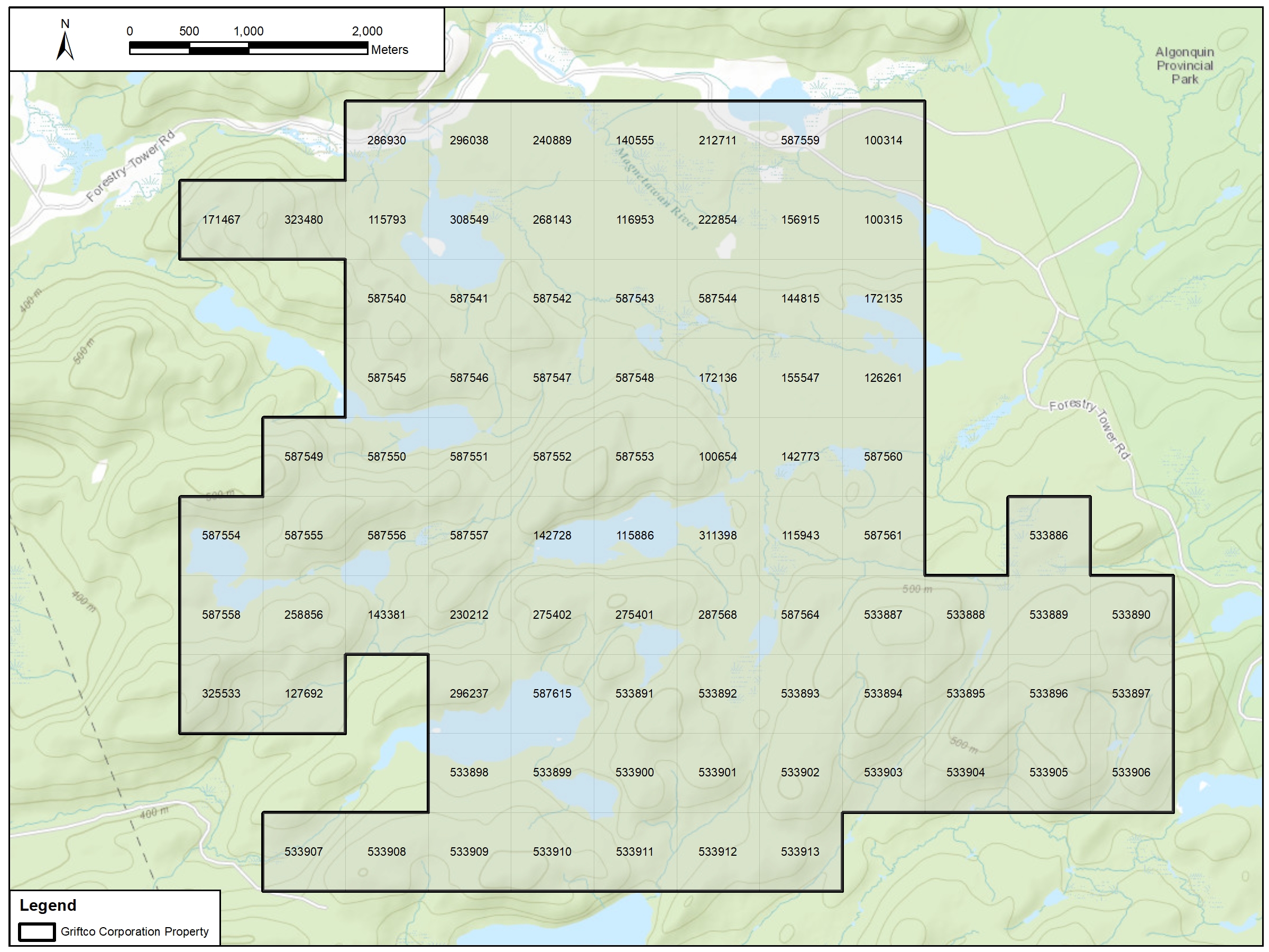
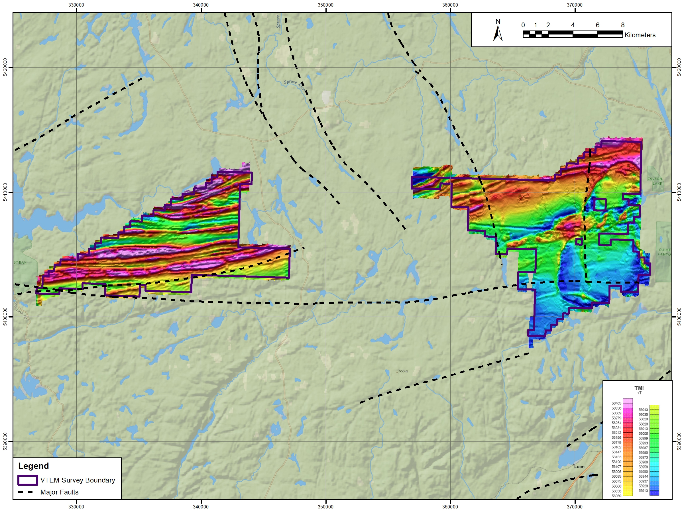
Assessment/ Technical Report Maps for Mineral Exploration & Mining Projects
Maps designated for exploration geology reports, with specialized figures for Access, Infrastructure, Geological and Geophysical datasets. Maps purposely made to display specific attributes, with intended use in report documentation or field operations/planning. Georeferencing and digitizing data from historical work.
With GIS figures designated to be used in the completion of assessment and 43-101 technical reports*.
*Applicable only when assisting in the completion of 43-101 technical/assessment reports, supervising QP is required for any official documentation.
Contact me for your project solutions: